
Project Team: Chile Water Resources II Team
Team Location: Langley Research Center, Hampton, Virginia
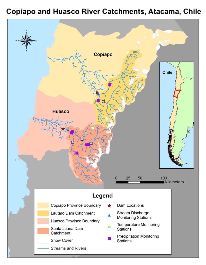
MODIS snow cover extent of the CopiapÌ_ and Huasco River catchments in Atacama, Chile.
Authors:
Jeffry Ely (Old Dominion University)
Lydia Cuker (Old Dominion University)
Joshua Kelly (University of Rhode Island)
Laura Macaluso (Christopher Newport University)
Joseph Novak (Old Dominion University)
Mentors/Advisors:
Dr. Kenton Ross (NASA DEVELOP National Science Advisor)
James Favors (NASA DEVELOP Deputy National Lead)
Past/Other Contributors:
Bethany Burress (Christopher Newport University)
Amberle Keith (Idaho State University)
Ajoke Williams (Massachusetts Institute of Technology)
Abstract:
Chile’s central-northern regions depend largely on seasonal Andean snowmelt and a system of dams to provide enough water to support a growing population and industry. These regions have seen a sustained decline in precipitation and are becoming increasingly arid. The Centro de InformaciÌ_n de Recursos Naturales (CIREN) maintains and interprets images and data as they relate to agriculture and natural resources within central-northern Chile. Currently, measurements are limited by sparse monitoring stations at the base of the mountains, and improvement is sought in the capability to forecast water availability and increase the effectiveness of water management policy. To highlight areas of desired study, historical changes in maximum and minimum snow cover extent between 2001 and 2013 were mapped using data from the Moderate Resolution Imaging Spectrometer (MODIS).
The Huasco and CopiapÌ_ basins in the Atacama region of central-northern Chile were identified as high drought impact regions, due in part to the presence of both agricultural and mining industries. Building on methodology established in a previous study of the LimarÌ_ basin, NASA Earth observation data from the Advanced Spaceborne Thermal Emission and Reflection Radiometer (ASTER), the Advanced Microwave Scanning Radiometer (AMSR-E), and MODIS were used with assistance from the Soil Water and Assessment Tool (SWAT) extension to delineate the watershed boundaries, analyze daily snow covered area, calculate basin temperature characteristics and assess the region’s soil moisture. Remotely sensed data were combined with in situ measurements from weather stations located in the area and were compiled into a set of basin characteristics for input into the Snowmelt Runoff Model (SRM) for simulation. Multiyear averages of specific basin parameters were developed to allow SRM to simulate a projected output three months into the future.
Executable scripts and accompanying tutorials were developed for use by the project partners in Chile for the upcoming 2014 melting season in September. In pursuit of a more comprehensive transfer of knowledge between the DEVELOP Program and the partners, additional tutorials were developed to guide users in further development of similar capabilities in other basins throughout Chile.
Back to VPS page.