
In a concerted effort to remediate the ecosystems along the channel of the Colorado River, Mexico and the United States recently reached a historic agreement to release water from the Morelos Dam at the Arizona-Mexico border. This Û÷pulse flow,’ is intended to reach the Colorado River Delta for the first time in 50 years.
On March 23, a historic bi-national agreement allowed for a ÛÏpulse flowÛ of water to travel through the lower Colorado River in hopes that it will reach the Colorado River Delta for the first time in 50 years. The dual effort of the United States and Mexico suitably follows the commemoration of World Water Day on March 22, and represents the first attempt to restore the diverse wetland ecosystem that once spanned 2 million acres but has recently been reduced by 90 percent to a currently arid landscape.
Made possible by Minute 319 ÛÒ a 2012 amendment to a 1944 treaty between the two countries ÛÒ the pulse flow event is meant to replicate the once-natural spring conditions of the river, when snowmelt in the Rocky Mountains would elevate rates of discharge through the channel.
Water for the pulse flow was released from Lake Mead and traveled 320 miles (515 kilometers) to the Morelos Dam on the Mexico-Arizona border. On March 23, the International Boundary and Water Commission opened the gates of the Morelos Dam, releasing 105,392 acre-feet of water to the lower Colorado River. The flow is ultimately meant to restore 70 miles (113 kilometers) of the river’s course and support vegetation growth, particularly the resurgence of flood-adapted cottonwood and willow trees.
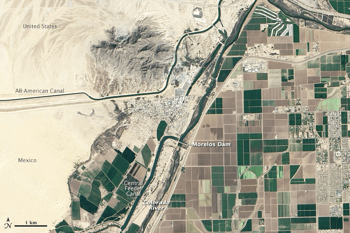
Image Credit: NASA Earth Observatory image of the Morelos Dam on the Colorado River at the Arizona-Mexican border by Jesse Allen and Robert Simmon, using Landsat data from the U.S. Geological Survey.
The Colorado River originates in the Rocky Mountains of Colorado and drains an expansive watershed that encompasses seven U.S. and two Mexican states, historically travelling 1,450 feet (2,330 kilometers) to its delta in the Gulf of California. By the time the river reaches the U.S.-Mexican border, however, most of its water has been diverted by agricultural operations in Southern California and Arizona, as well as for use by the cities of Denver, Las Vegas, Los Angeles, San Diego, Phoenix and Tucson. The water that does reach the Morelos Dam is then allocated to Mexico’s Mexicali Valley for crop irrigation.
Other than during a flood event in 1983, the Colorado River has not reached the Sea of Cortez in the Gulf of California since 1960, according to the Environmental Defense Fund. This multi-decadal depletion of water not only desiccated the landscape, undermining the diverse ecosystems along the channel and in the delta, but also diminished nutrient transport to the Sea of Cortez, previously considered one of the world’s most productive fisheries. Although the pulse event only represents 1 percent of pre-dam annual flow, scientists expect, or at least hope, that the contribution will begin the necessary, albeit arduous, process of restoration.