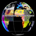
When the White House’s National Science and Technology Council issued its latest report on Earth observation in April, one of the goals it set out was to improve user engagement. According to the National Strategy for Civil Earth Observations, ÛÏMechanisms for engaging user communities will be developed to cultivate wider application and use of Earth observations.Û
Solar Power Remains Popular in Germany, Despite Cost
According to a new poll, 82 percent of Germans support the country’s transition to renewable energy, known as the Energiewende. The poll by the Federation of German Consumer Organizations (Verbraucherzentrale Bundesverband) found some discontent with some aspects of the project, however, particularly with the cost.
Making Science Accessible to Environmental Advocates
 The Statistics for Action (SfA) project provides new opportunities for engaging the community with science. The project is coordinated by TERC, a not-for-profit educational research organization in Cambridge, Massachusetts, specializing in math and science learning. SfA has designed practices, materials, and resources to make data and science more accessible and relevant to communities concerned about their local environment. Two stories, detailed here, illustrate the approach.
Application of Next-Generation Satellite Data to a High-Resolution, Real-Time Land Surface Model
![Figure showing Difference plots (LIS minus control) of a 13-hour forecast valid at 1600 UTC, June 9, 2008, for the following fields: a) sensible heat flux (W m-2), b), 2-m dew point temperature (in degree Celsius), c) PBL height (m), and d) CAPE (J kg-1). Adapted from [5]. Figure showing Difference plots (LIS minus control) of a 13-hour forecast valid at 1600 UTC, June 9, 2008, for the following fields: a) sensible heat flux (W m-2), b), 2-m dew point temperature (in degree Celsius), c) PBL height (m), and d) CAPE (J kg-1). Adapted from [5].](https://ieeeearthzine.wpenginepowered.com/wp-content/uploads/2013/04/Diff-in-CNTL-150x150.jpg) A suite of real-time soil characteristic products for the contiguous United States will be enhanced by data from the upcoming Soil Moisture Active Passive (SMAP) and Global Precipitation Measurement (GPM) satellite missions. These products are used by operational weather forecasters to aid in analyzing and forecasting drought, extreme heat, and convective initiation.
A suite of real-time soil characteristic products for the contiguous United States will be enhanced by data from the upcoming Soil Moisture Active Passive (SMAP) and Global Precipitation Measurement (GPM) satellite missions. These products are used by operational weather forecasters to aid in analyzing and forecasting drought, extreme heat, and convective initiation.


