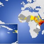
 New technologies and study methods allow scientists to make increasingly accurate predictions about regional weather patterns, but whether these data prove useful depends upon the ability of stakeholders to act on the information they receive.
The SERVIR Project: Serving International Communities with Critical Earth Observation Data
 The SERVIR program, a joint project of NASA and USAID, is named after the Spanish word meaning ÛÏto serveÛ, and it is doing exactly that; it provides web-based satellite images and other data to scientists, environmental managers, and decision makers. With this data being made ready and available, policy choices can be made regarding climate change, biodiversity, flooding, forest fires, and storms by addressing the variability of these issues.
Keeping an Eye on Africa
 In 2007, an international group of organizations launched “African Monitoring of the Environment for Sustainable Development” (AMESD). The project, which involves the European Commission, the European Organisation for the Exploitation of Meteorological Satellites (EUMETSAT), the Commission of the African Union, five participating African Regional Economic Communities and the Secretariat of the African, Caribbean and Pacific Group of States (ACP) , is focused on improving African use of Earth observation tools.
GEOSS in the Americas Leverages International Resources for Action
 What can satellite-based Earth Observation do for the Americas? The possibilities are endless. From mitigating disaster outcomes in earthquake-prone states like Haiti to managing agriculture in Brazil to observing algal blooms off the coast of Mexico, GEOSS Americas is already having a major positive impact.
CBERS: a Chinese-Brazilian Collaboration
 What do you do if you’re home to some of the world’s most significant natural resources, but you don’t have the technology to place satellites in orbit? In Brazil’s case, the answer is a long-lived collaboration with China called CBERS (China-Brazil Earth Resources Satellite), which started in 1988 and is still going strong. Today, Brazil has the ability to launch its own satellites, but the two nations continue their partnership.
- Page 1 of 2
- 1
- 2


